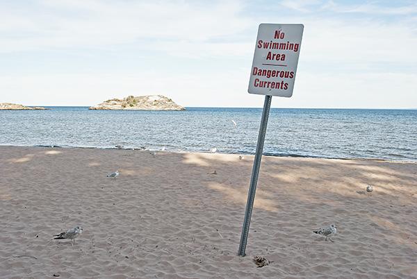
Regardless of how long someone has been a student at NMU — a couple weeks or five years — the dangers of Lake Superior are evident.
From the posters on campus and warnings from NMU staff and Marquette community members, it is well-known that Lake Superior rip currents can be dangerous for any swimmer in spite of experience or strength.
However, students are rarely given the most specific — and important — information regarding rip currents and swimmer safety in Marquette County.
Details like where the strongest rip currents are and how they’re created, or where someone can hone their skills before advancing to the sometimes vicious waters of Lake Superior, are much more helpful than mere warnings.
“You see the signs a lot around campus and at the beaches that warn about rip currents,” said NMU student Ben Raiche, an outdoor recreation major. “And of course how every year or every other year, you hear about a student that swims when they probably shouldn’t have and just got into a bad situation.”
Rip currents — or a small current that work away from the shore — are attributed to nearly 32 incidences in Lake Superior as a whole since 2002. Eleven of those were deaths, while the other 21 were near-deaths according to the Marquette National Weather Service (NWS).
While most rip currents are associated with sand bars, they have been known to develop in such places as Middle Bay near Presque Isle, popularly known as The Zoo.
Despite being a lesser-known swimming area, four of the previously mentioned 32 incidents occurred at The Zoo, two of which were deaths, as recorded by the Marquette NWS.
The area, situated on the west side of the island, can experience four to six foot swells when winds are high, making it more popular for surfing and windsurfing than for swimming.
Just as many things can factor into how a swimming area becomes high-risk-like water depth, offshore obstacles, a bay location or a man-made obstacle-many things also factor into what makes a certain day high-risk.
“Typically when we see the most high risk days, we see a cold front dropping south across Lake Superior, so we get strong northwesterly winds and larger waves,” said Megan Dobson of the Marquette NWS.
Another frequented swimming and cliff jumping area is Little Presque Isle, which with both channel currents and coves that allow for large waves is a dangerous place for those not completely comfortable with their swimming abilities.
“I like going out to Little Presque and cliff jumping back there, but I was out there one time this summer and there were probably five to six foot swells coming into that little cove,” Raiche said, referring to the coves on the back side of the island near the cliff-jumping area. “I had made the decision to jump into the water and it was pretty scary.
“I think that’s just that area back there, water just kind of funnels into the bays.”
But unlike Middle Bay, the inherent dangers associated with cliff jumping and Picnic Rocks are two things students are generally knowledgeable of. Picnic Rocks, however, is not actually affected by a rip current but instead by a current channel, as seen on the National Oceanic and Atmospheric Administration’s (NOAA) website.
In order for a current channel to exist, the water has to be squeezed through an offshore obstacle (typically rocks) and the shore to create a strong sweeping current, much like a water treadmill.
Fifteen people have drowned at Picnic Rocks since 1963, including two NMU students in 2005 and one in 2010.
The most important information to remember when dealing with rip currents and current channels is how to swim safely to shore after being caught in one.
With rip currents, which move perpendicularly to the shore, it’s critical to swim parallel to the shore and not against the current, according to the Marquette NWS.
However, with channel currents, it’s important to understand that the water is pushing in a distinct direction as it’s being squeezed through a small space.
Swimming backwards or against the current is not advised, whether there is a sandbar close or not.
Instead, it is recommended to carry with the current until it loses strength, and then swim towards shore.
However, for those who prefer natural water to a swimming pool, the safest bet would be a lifeguard-protected beach.
Danger zones, including Picnic Rocks, piers and most of the water around Presque Isle should be avoided altogether — whether swells are large or not.
The areas in Marquette that should be avoided have been marked appropriately, warning of any potential for strong currents.
Avoiding these areas is crucial for one’s own survival and well-being, but it is equally important to know how to handle a strong current.
Dobson said August is the time they see the most drowning accidents in Marquette, however despite a decline in swimmers in the fall months, wind and wave patterns are even more dangerous because of falling water temperatures.
For more information and updates on the different currents in Lake Superior, visit www.ripcurrents.noaa.gov.


